In perilous pursuit of pelicans
birds by Vagrant GautamThe time when I just wanted to look at some pelicans, but it sort of got out of hand.
It all started because I wanted to see pelicans.
The only American white pelican nesting colony in British Columbia is Stum Lake in White Pelican Provincial Park. The lake is closed from March to August to protect the pelicans so I decided to go in the first week of September to see if I could spot any stragglers who hadn't flown east yet.
This was going to be a bit of a road trip because Stum Lake was over 600 kilometres away from where I lived in Vancouver. When I looked up the route on Google Maps it looked like there were some forest service roads on the route which in my experience are often unpaved. So considering that I had a small car and there was going to be some offroading involved in getting there, I decided I would play it by ear and only do what I was comfortable with - even if that meant giving up without seeing pelicans.
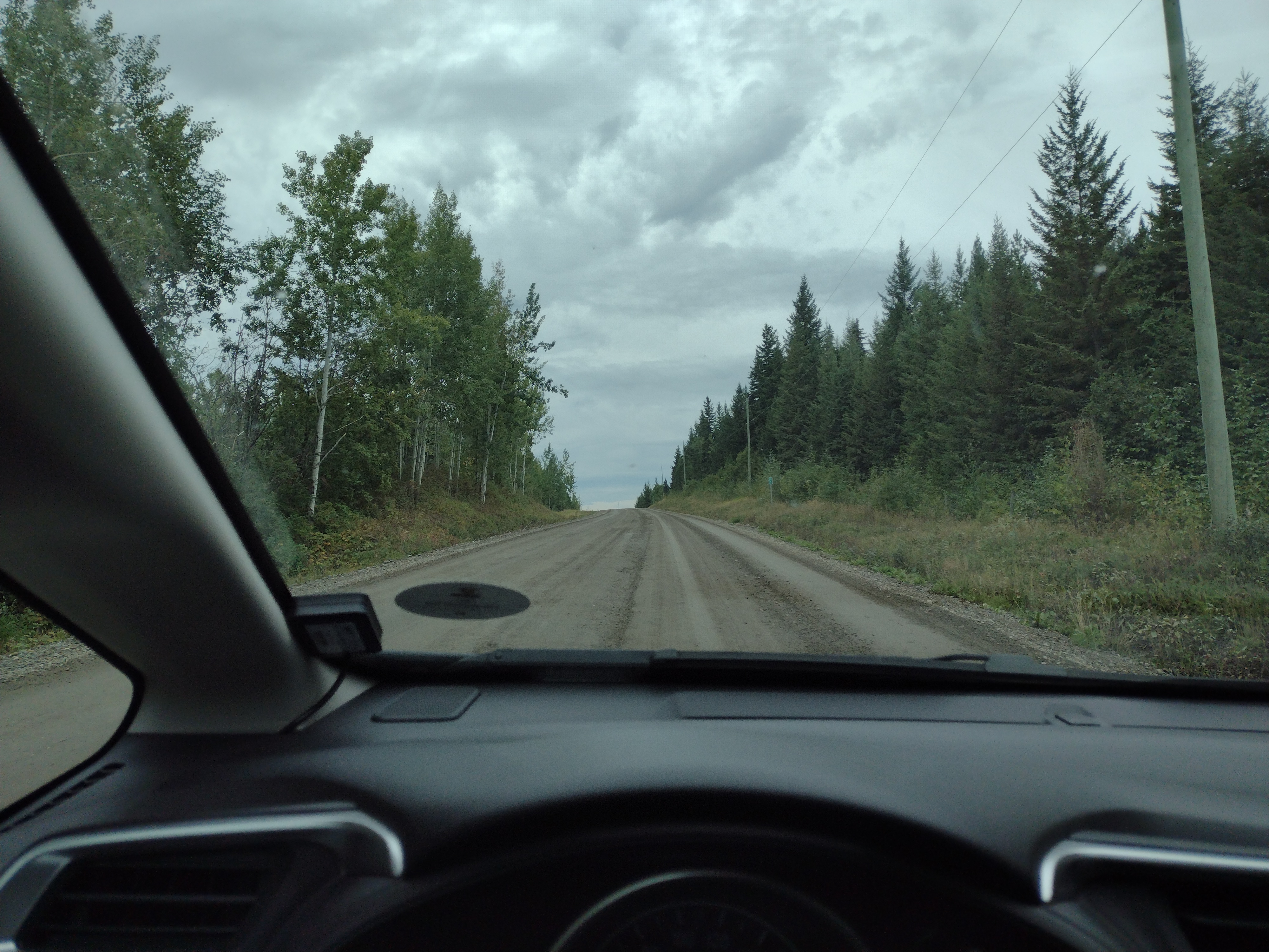
I got off a paved road and onto a dirt road at 1512 kilometres on the odometer.

If you've never been in a small car on a dirt road - it's very, very loud. It's like a loud, deep rumble that you feel with your whole body because it's bumpy. You feel like you're being shaken alive. You hear little stones clanking against the sides and the bottom of your car.
I saw a little black bear on the side of the road that hurried into the forest when I zoomed by. A couple of times I saw families of deer crossing the road in front of me. I also stopped a few times to look for birds.
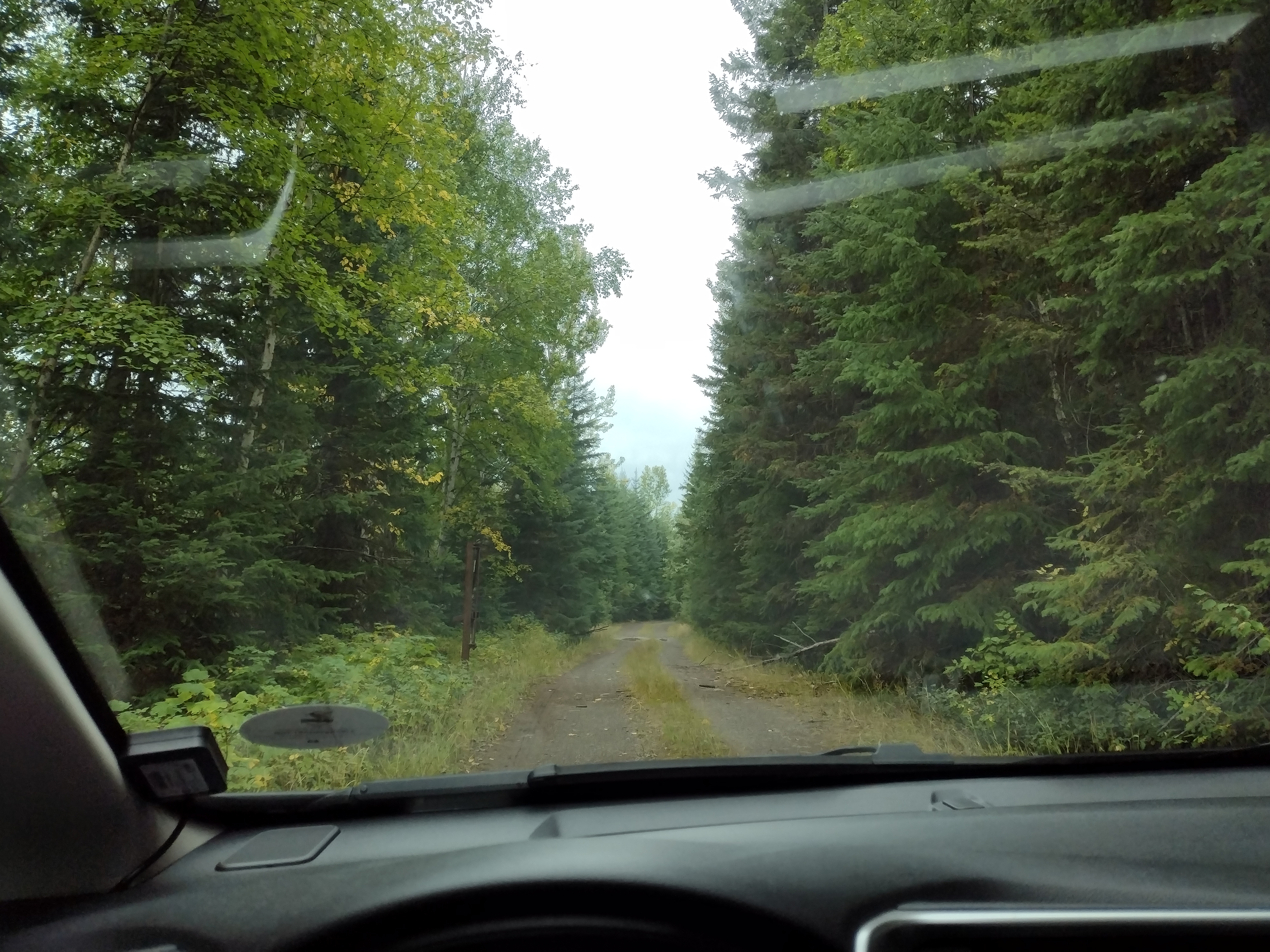
At some point, Google made its first mistake. It made me turn right onto this narrow two-track road in the middle of the forest. When done recreationally, driving on two-track roads is also called greenlaning because in between the two tracks that are made by tires, weeds and plants grow freely because they aren't run over by tires or feet. A "green lane."

I went down this path for 3 kilometres all the while hoping that I wouldn't run into another car going the other way because the path had narrowed quite a bit and there was no real way to turn. It had also rained all morning and so there were several muddy puddles along the path. Every time I went over them I just hoped against hope that they weren't deeper than they looked and that I wasn't going to get stuck.
Then I reached a fence. This would have been exciting if I wasn't still something like 50 kilometres away from the park. There was no choice but to go back because this route was a dead end. Like I said earlier, the path had narrowed too much to be able to turn without hitting trees, so I ended up having to back up for 2 kilometres before I could make a turn. It was stressful. At this point I could've chosen to give up and turn around but I just laughed it off, chalked it up to adventure, and continued on a new route that Google gave me - back on the dirt road I'd turned off of.
The road with a real name turned into a forest service road which later turned into a nameless road. I had 43 kilometres to go and I also noticed that I'd lost cell service.
Really, it would've made a lot of sense to go back at this point, but the pull of the pelicans was too strong so I kept going. The scenery changed. The trees became shorter and the terrain became much more hilly. Almost my whole drive I'd been seeing signs warning me to watch for logging trucks, but now it was a lot visually clearer that I was in logging country - in the distance I could see clearings. It was a Saturday so there were no logging trucks around. In fact, I saw no one at all. No trucks, no cars, no humans, and I'd been driving for quite a while already.
Eventually I got to a fork in the road where Google said I could take either fork and they both had a similar ETA because they joined up again later. Both paths were two-track roads like the one I went on earlier, except these were gravel roads and a lot rockier. I picked the left one and started down it. It was quite beautiful - I was on a mountain covered with short shrubby foliage so I could see down into the valley, and the sky was a gorgeous blue punctuated by fluffy cumulus clouds.
Unfortunately, this was the beginning of the end. As I went on, the path got more and more challenging. It narrowed and got rockier, the green lane in the middle had taller plants, and there started to be big height differentials between the two tracks that my wheels were supposed to go on. The sound of plants tickling the belly of your car is a bizarre sound. I thought I wouldn't be able to hear it, that it would be like feathers on metal. But no, you can actually hear it - it sounds almost like soft kitty claws on metal. When one side of your car is much higher than the other, it really feels like you're going to topple over. Luckily I didn't, but it started to feel sketchy. I wasn't going anywhere near the 60 km/h that Google expected me to (in order to cover 43 kilometres in 44 minutes). I was going somewhere between 5 and 20 km/h - anything faster in that car would've been a terrible idea.
Then the path itself started to incline up and down more violently. I did 2 downhill runs where I found myself literally holding my breath as I held the brake and eased the car down. I'd been trying this experiment for 70 kilometres already and at this point, I decided that enough was enough and I should cut my losses and go back. To turn around, I had to execute a careful 10-point turn on this narrow dirt path so that I didn't fall into the pits that were on either side. When I tried to climb back up those last couple of downhill runs, my tires struggled to find traction and started spinning. They pulled through but after I was on a more level part of the path, I stopped to change the destination on my Google Maps app. When I looked at the map, it showed me way off any marked path, in the middle of nowhere. I'd followed all its directions and I'd seen no other paths on the way that I could turn onto. So this made me panic.
This was when it really hit me that this had been a bad idea. I was out alone in the middle of nowhere with no way to describe where I was to anyone - not that I could even reach anyone because remember, I had no cell service! I theoretically know how to change a car tire but I've never actually had to do it. And what would happen if rocks damaged the underside of the car and all the fuel leaked out and I was stuck there?
I just wanted to go home.
Eventually I talked myself down and set up the maps app and began to go back. The app made another mistake - it had me turn into a field that opened out onto a path, and then wanted me to turn onto a path that was blocked by a horizontal log. I gave up on the app and tried to retrace my steps from memory. I saw a tree branch I recognized that told me I was on the right track and I laughed at the absurdity of that. After that gravel nightmare I was utterly relieved to be back on the wide dirt road. I never thought I'd be so grateful to be on a dirt road but going from a terrible road to a bad road will make you feel like that.
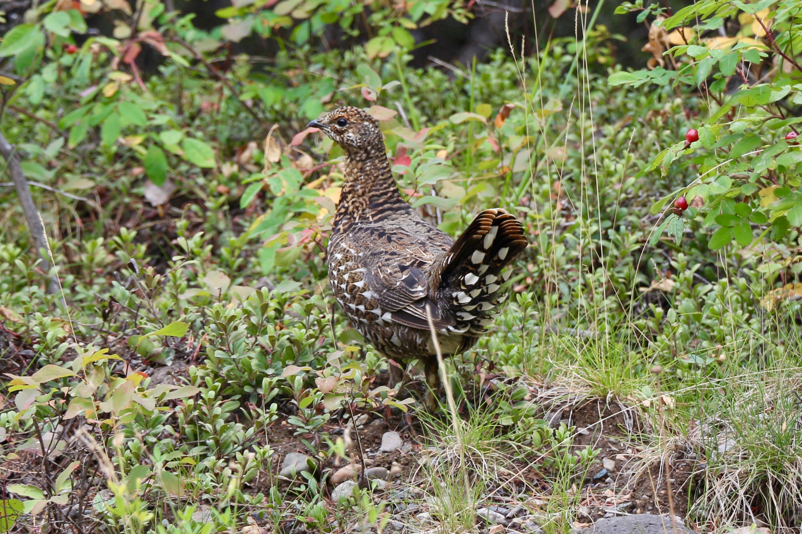
So no, I didn't see any pelicans. But the universe was kind enough to grant me a spruce grouse on my way back.

- Next post: Code crimes: mama and beer
- Previous post: Switch by Siouxsie and the Banshees is a trans anthem
- Back to the archive